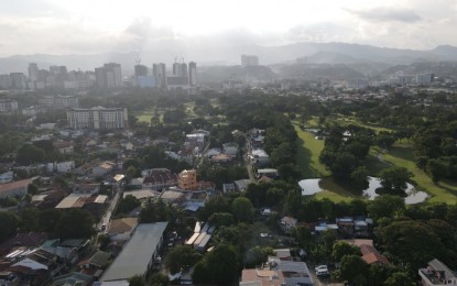
GEOHAZARD MAPS. Aerial of the Cebu City uptown area leading to the hinterland barangays. The Mines and Geosciences Bureau on Friday (August 7, 2020) urges Central Visayas local government units to utilize the geo-hazard maps in strengthening their disaster preparedness measures, especially with the onset of the rainy season. (Photo courtesy of Jun Nagac)
CEBU CITY – The capability of local government units (LGU) in Central Visayas in enhancing their disaster preparedness measures, especially with the onset of the rainy season, can be strengthened using the geo-hazard maps, the Mines and Geosciences Bureau (MGB) in Region 7 said on Friday.
Josephine Aleta, supervising geologist of the MGB-7’s Geohazards and Engineering Geology Section, emphasized the importance of geohazard maps in disaster prevention.
“We are encouraging LGUs to use it for their comprehensive land-use plan. They can use it as a guide in determining the areas where they can develop,” Aleta said in mixed Cebuano and English in a virtual interview here.
Geohazard maps are specialized maps that indicate the hazard susceptibility of areas and are found to be useful for disaster preparedness and management, she said.
The geohazard maps developed by MGB contain information on areas susceptible to rain-induced landslides and flooding.
With the onset of the rainy season, Aleta said MGB has also issued "red advisories" for LGUs that might be vulnerable to tropical cyclones, including barangays that are prone to landslides.
In 2017, MGB-7 distributed the geohazard maps to various LGUs in the region. The agency is currently updating its geohazard data.
“In the course of our regular activities, we are also updating our geohazard data. So rest assured, MGB is doing its best to update our geohazard data so they can use it for their developmental programs,” said Aleta.
In Region 7, areas that are more prone to landslides are the northern portion of the provinces of Cebu and Negros Oriental.
She said that “geohazards do not have to become a disaster if people are informed and prepared.”
The geohazard maps can be accessed through www.mgb.gov.ph or gdis.mgb.gov.ph/mgbpublic. (PNA)
